In short
- Spring tides with coefficients above 95 fill the bay around the Mont; the equinox months (March, September) bring the biggest.
- In 2026 the official booklet flagged an island risk on 14 August (high water 9:28 PM local time, coefficient 102) and 12 September (9:02 PM, coefficient 101), plus a one-hour cut-off on the morning of 21 March.
- The path through the rocks replaces the main gates on many more days; the last ones in 2026 are 25–27 November and 25–27 December.
- No boats: when the esplanade floods you wait about an hour. Be in place 60–90 minutes before high water.
What makes a "grande marée"
A grande marée (big tide) is a spring tide with a high coefficient – in practice 95 and above. These come twice a month after new and full moon, and they peak around the March and September equinoxes, when the Sun and Moon line up over the equator. They are bigger still when the Moon is at its closest to Earth.
At the Mont, a big spring tide means the sea rushes across the flats, fills the Couesnon channel and wraps around the rock, sometimes reaching the foot of the ramparts and the bridge piers. It is the moment the Mont looks most like its medieval nickname, Saint-Michel-au-péril-de-la-mer – Saint Michael in peril of the sea.
| Date | High tide | Access | Source |
|---|---|---|---|
| Wed, 25 Nov 2026 | 7:02 AM Coefficient 96 7:30 PM Coefficient 97 | Gate access disrupted 6:30 AM–7:30 AM, 7:05 PM–7:55 PM | Official |
| Thu, 26 Nov 2026 | 7:47 AM Coefficient 97 8:16 PM Coefficient 96 | Gate access disrupted 7:10 AM–8:30 AM, 7:55 PM–8:45 PM | Official |
| Fri, 27 Nov 2026 | 8:33 AM Coefficient 94 9:06 PM Coefficient 91 | Gate access disrupted 8:00 AM–9:00 AM | Official |
| Fri, 25 Dec 2026 | 7:41 AM Coefficient 97 8:16 PM Coefficient 99 | Gate access disrupted 7:10 AM–8:20 AM | Official |
| Sat, 26 Dec 2026 | 8:31 AM Coefficient 99 9:05 PM Coefficient 99 | Gate access disrupted 7:50 AM–9:10 AM | Official |
| Sun, 27 Dec 2026 | 9:19 AM Coefficient 96 9:51 PM Coefficient 94 | Gate access disrupted 8:50 AM–10:00 AM | Official |
| Sat, 23 Jan 2027 | 7:38 AM Coefficient 102 8:10 PM Coefficient 105 | Gate access disrupted 7:00 AM–8:20 AM, 7:40 PM–8:50 PM | Estimate |
| Sun, 24 Jan 2027 | 8:24 AM Coefficient 107 8:54 PM Coefficient 107 | Island tide 7:55 AM–8:55 AM Gate access disrupted 7:25 AM–9:25 AM, 8:15 PM–9:45 PM | Estimate |
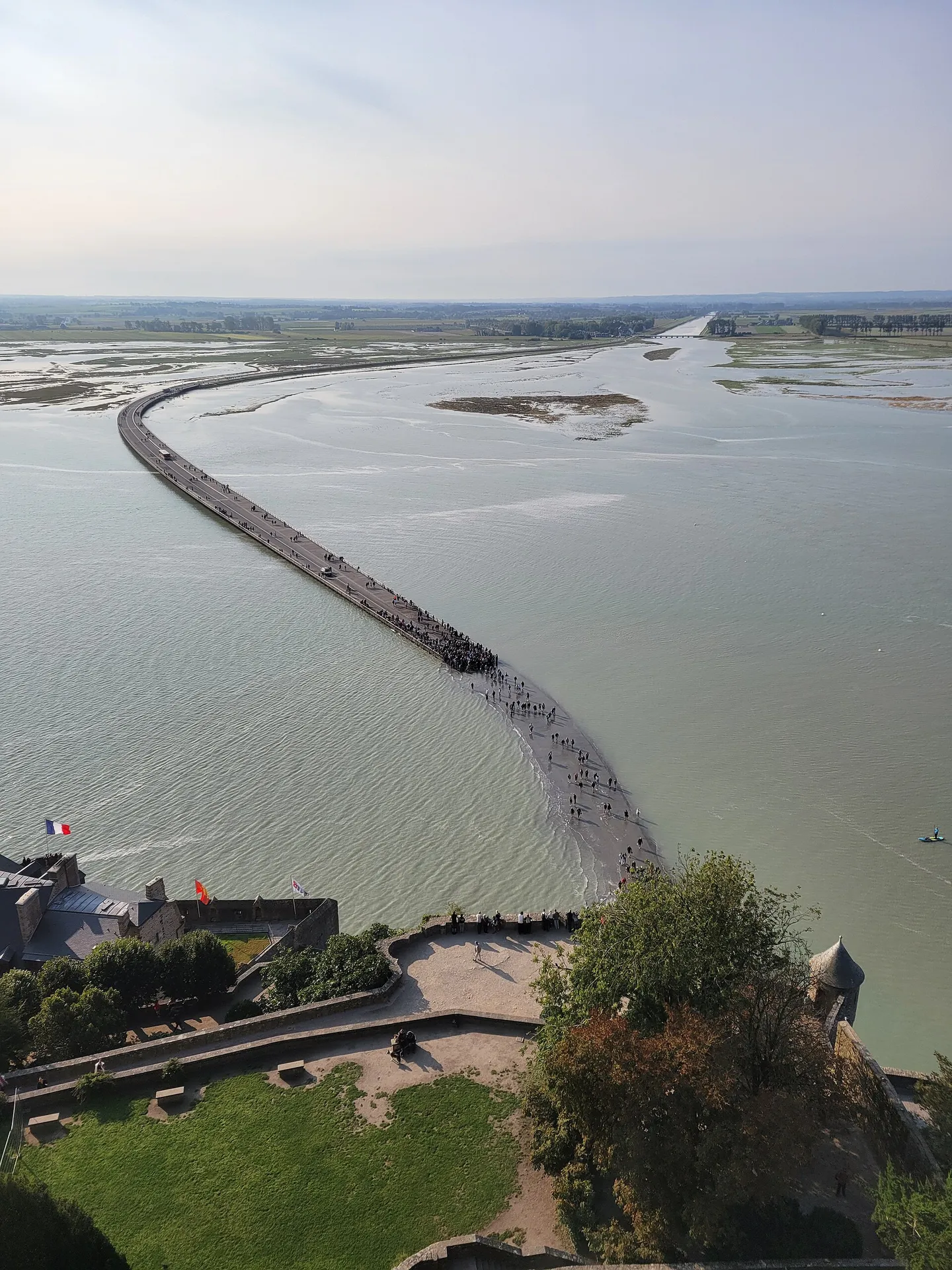
What Mont-Saint-Michel looks like at high tide
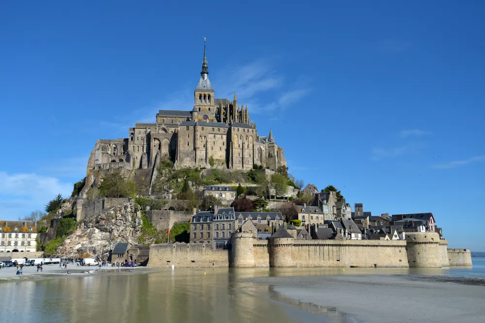
At low tide the Mont stands in a plain of sand and mud; the sea can withdraw up to about 15 km at the biggest tides, according to the Abbey's official site. As the tide turns, water first slides into the channels of the Couesnon and the other rivers, then spreads across the flats in a thin, shining sheet. On a spring tide of about 95 or more the bay fills right around the rock: from the bridge you see the Mont standing in open water, the bridge piers and the dam half-submerged, and the reflections of the ramparts on the surface.
How fast does it come in? The old saying is that the tide comes in "at the speed of a galloping horse". The Abbey's official site puts it plainly: in reality it advances at about 6 km/h on average – walking pace. The danger is not raw speed but the shape of the bay: the water fills channels behind you before it reaches you, and on spring tides the current is strong.
The tidal bore (mascaret). On big tides the rising water pushes a small wave up the rivers of the bay. At the Mont you can see it on the Couesnon, about 1½ to 2 hours before high water, from the dam just in front of the Mont.
Where to watch. The Abbey's West Terrace – the official site calls it the most exceptional viewpoint on the rock – and the Abbey gardens look straight down on the incoming water if your visit times right. Without a ticket, use the north and west ramparts, the end of the bridge near the Mont, or the dam on the Couesnon for the bore. Be in place 60–90 minutes before high water.
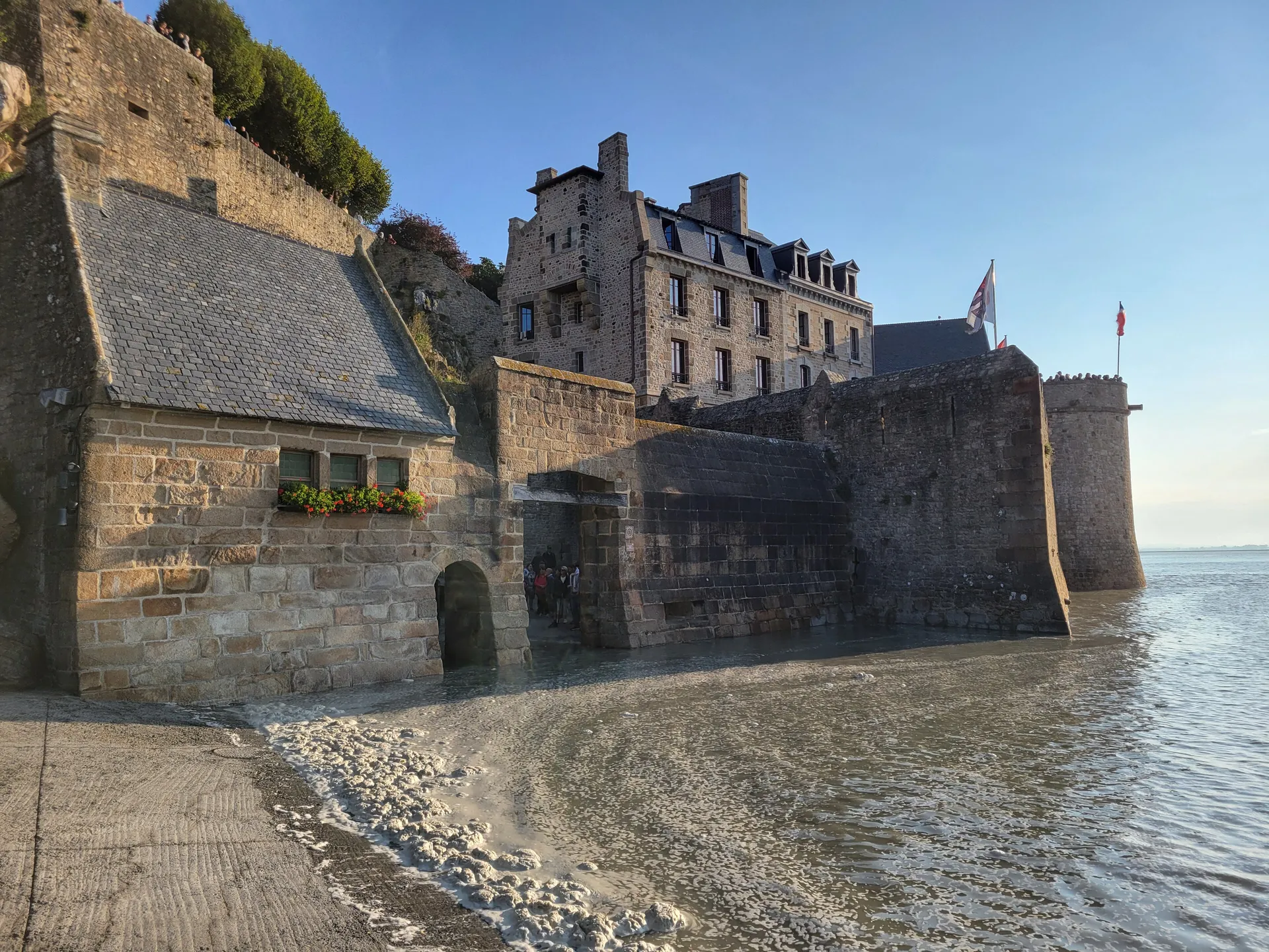
How often is it truly surrounded? Water reaches the rock on many spring tides each month, but the esplanade in front of the gates floods – making the Mont a real island – only a few times a year, for about an hour each time.
Island days and disrupted access in 2026
Since the 2014 bridge replaced the old causeway, the Mont is connected on almost every day. It becomes a true island only when the sea covers the esplanade (the terre-plein) between the end of the bridge and the gates. The Établissement public du Mont-Saint-Michel lists these days each year in its Informations marées booklet. For 2026:
| Date (2026) | High water | Coefficient | Height (booklet scale) | Access cut off |
|---|---|---|---|---|
| Saturday 21 March | 8:39 AM | 103 | 12.75 m | 8:10 AM–9:10 AM |
| Friday 14 August | 9:28 PM | 102 | 12.79 m | 9:00 PM–10:00 PM (island-risk reminder) |
| Saturday 12 September | 9:02 PM | 101 | 12.79 m | 8:30 PM–9:30 PM (island-risk reminder) |
Biggest tides and island days in 2027 (our estimates)
The official EPMSM tide booklet for 2027 had not been published in November 2026. Until it is, this table shows our own predictions of the high waters that should reach the island threshold – the times when the esplanade in front of the gates is likely to flood and the Mont becomes an island for about an hour. They come from the same harmonic model as our tide table (methodology), calibrated against the 2026 booklet.
Our model flags 20 high waters on 16 days. The official list may be shorter or longer: in 2026 the booklet named only three cut-off days, because it applies its own thresholds and safety margins. Treat these dates as the days to watch, not as guaranteed island days, and check the official booklet when it appears (usually around December).
| Date (2027) | High water | Coefficient | Height (booklet scale) | Estimated cut-off |
|---|---|---|---|---|
| Sunday 24 January | 8:24 AM | 107 | 12.90 m | 7:55 AM–8:55 AM |
| Monday 25 January | 9:08 AM | 106 | 12.96 m | 8:40 AM–9:40 AM |
| Monday 22 February | 8:08 AM | 111 | 13.11 m | 7:40 AM–8:50 AM |
| Monday 22 February | 8:33 PM | 111 | 12.86 m | 8:05 PM–9:05 PM |
| Tuesday 23 February | 8:47 AM | 109 | 13.14 m | 8:15 AM–9:25 AM |
| Wednesday 24 February | 9:22 AM | 102 | 12.81 m | 8:50 AM–9:50 AM |
| Tuesday 23 March | 7:43 AM | 106 | 12.88 m | 7:15 AM–8:15 AM |
| Wednesday 24 March | 8:19 AM | 104 | 12.81 m | 7:50 AM–8:50 AM |
| Tuesday 3 August | 8:59 PM | 106 | 12.87 m | 8:30 PM–9:30 PM |
| Wednesday 4 August | 9:44 PM | 108 | 13.09 m | 9:15 PM–10:25 PM |
| Thursday 5 August | 10:26 PM | 105 | 12.96 m | 9:55 PM–10:55 PM |
| Wednesday 1 September | 8:41 PM | 111 | 13.19 m | 8:00 PM–9:20 PM |
| Thursday 2 September | 9:07 AM | 112 | 12.97 m | 8:40 AM–9:40 AM |
| Thursday 2 September | 9:22 PM | 112 | 13.31 m | 8:45 PM–10:15 PM |
| Friday 3 September | 9:46 AM | 109 | 12.93 m | 9:15 AM–10:15 AM |
| Friday 3 September | 10:00 PM | 106 | 13.06 m | 9:30 PM–10:40 PM |
| Thursday 30 September | 8:16 PM | 108 | 13.05 m | 7:45 PM–8:45 PM |
| Friday 1 October | 8:39 AM | 108 | 12.88 m | 8:10 AM–9:10 AM |
| Friday 1 October | 8:55 PM | 107 | 13.03 m | 8:25 PM–9:25 PM |
| Saturday 2 October | 9:16 AM | 104 | 12.77 m | 8:45 AM–9:45 AM |
How to plan a spring-tide visit
- Pick a date in our tide table with a coefficient of 95+ and a high water in daylight or at dusk.
- Book your Abbey ticket for the morning or early afternoon so that you finish at least 1½ hours before high water.
- Book a room on the Mont or at La Caserne if high water is in the evening – the last shuttles are busy and the light is best then. See where to stay.
- Be in position 60–90 minutes before high water: the bridge, the west ramparts, the Abbey's West Terrace or the Couesnon dam for the tidal bore (1½–2 h before high water).
- If the esplanade floods, wait on the bridge or in the village. The water usually drops within about an hour; there is no boat.
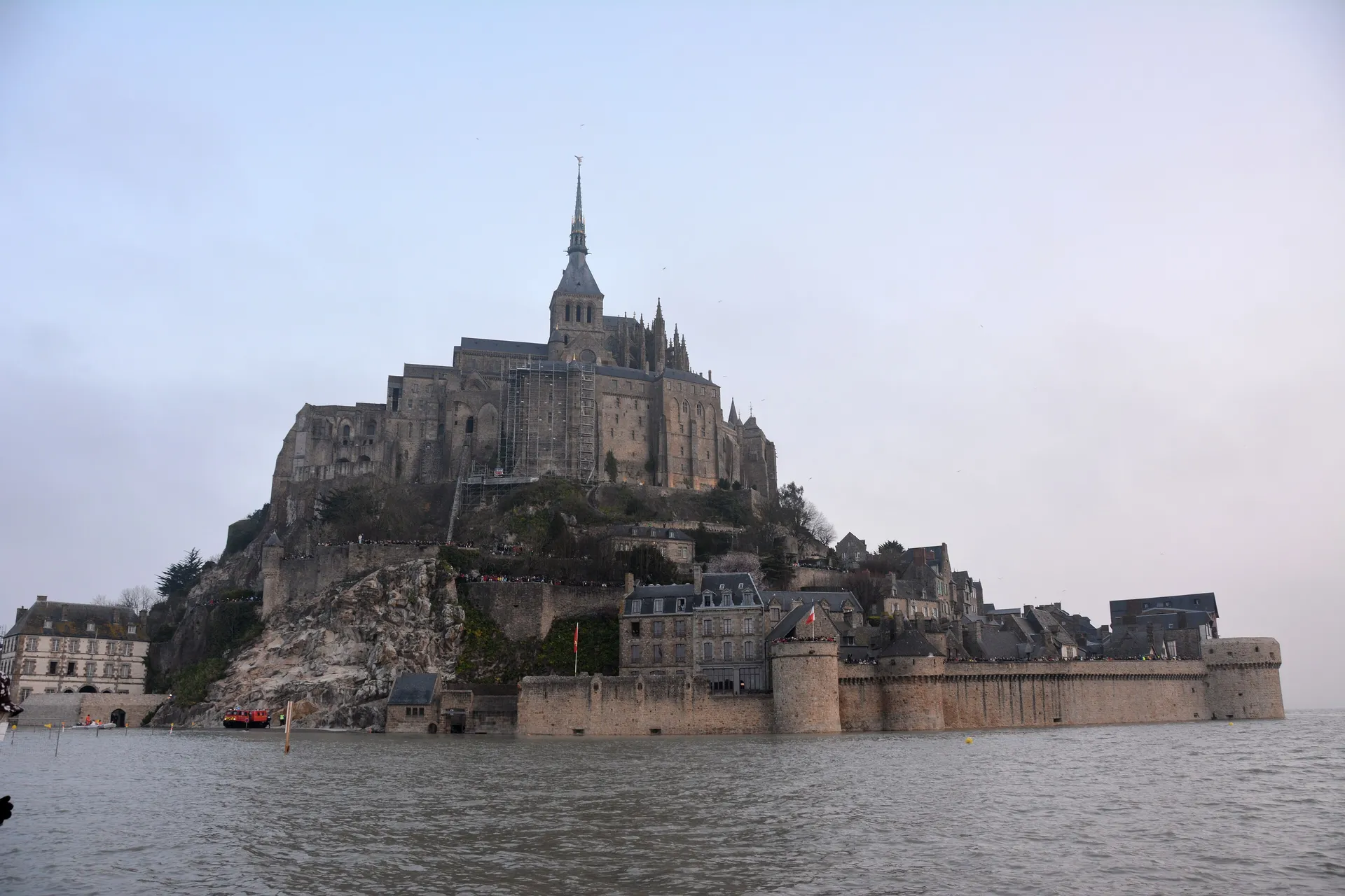
Water around the Mont at the spring tide of 21 March 2015.
Crowds, parking and red days
Big tides on summer weekends draw big crowds, and the site manager designates certain peak days as "jours rouges" (red days), with higher coach rates and compulsory coach booking. Cars are not barred, but the car parks fill and the shuttle queues grow. Arrive before 10:00 AM or after 4:00 PM, use the online parking discount (practical info), and consider a winter or equinox spring tide instead – March and late September are often as spectacular as August, with a fraction of the people. In 2027 the red days include 3 and 4 August, which coincide with one of the summer's biggest evening tides (our estimate). Travelling by bus? On some spring-tide dates the Pontorson bus does not serve its stops at the Mont end and uses the "Le Verger – Lignes publiques" stop instead.
Weather changes the picture: a strong westerly wind and low pressure can push the water higher and earlier than predicted, and an easterly with high pressure can hold it back. Watch the forecast as well as the table.
Watching the tide safely
Spring tides are also when the bay is most dangerous. The water fills channels around sandbanks, the current is strong, and the edges of the rock become slippery. Stay off the sands from about three hours before high water, keep children close on the bridge edges and ramparts, and do not stand on the esplanade once stewards ask you to move.
The safest way to experience the tide up close is with a certified bay guide, who will time the walk so you are back on solid ground well before the water. See bay walks.
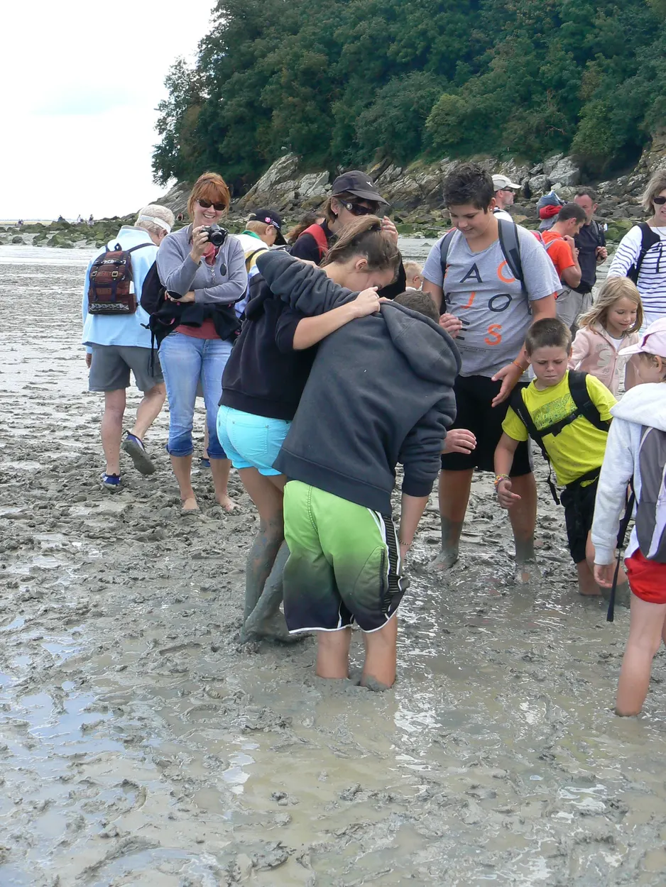
Full bay crossing on foot with quicksand
Follow the pilgrims' route across the sands to the Mont with a certified guide, quicksand demonstration included.
Check availabilityBook via GetYourGuide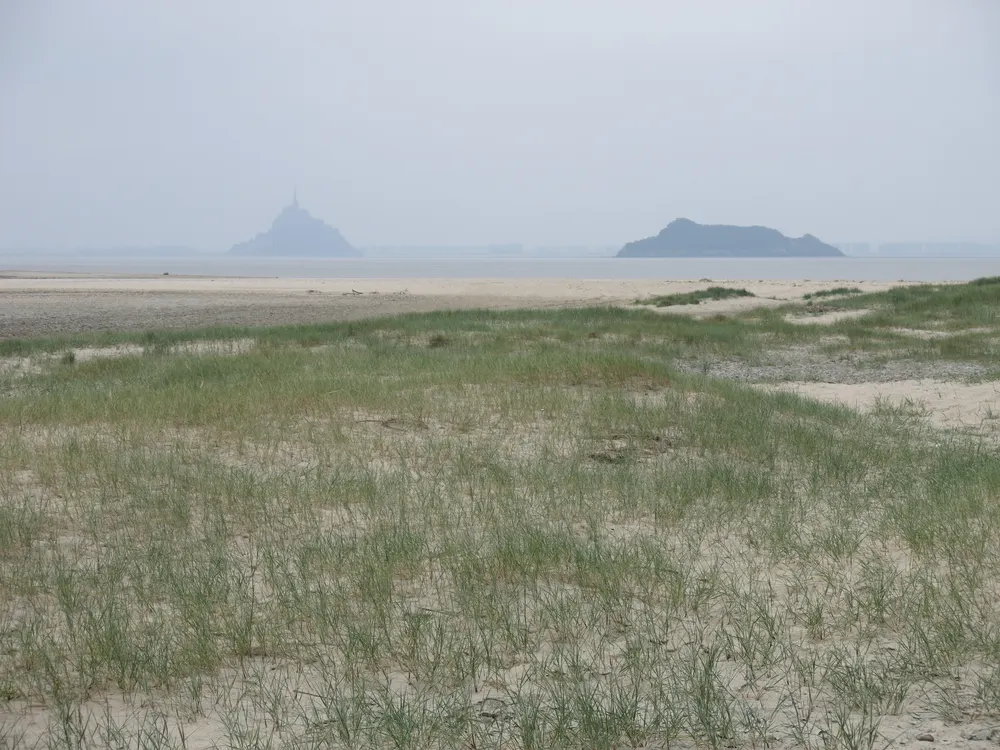
Guided crossing to Tombelaine islet
Walk across the sands with a guide to the bird-island of Tombelaine, facing the Mont.
Check availabilityBook via GetYourGuideTour listings are on GetYourGuide. Prices, times and cancellation terms are shown live on each listing and can change; MontSaintMichel.com may earn a commission at no extra cost to you.
Photographing the big tides
For the classic reflection, shoot from the bridge or the shore near the dam on a calm evening as the water settles around the rock. For the rush of the tide, go higher: the north and west ramparts and the Abbey gardens look straight down on the channels. At night, the floodlit Mont above a full bay is the shot most people come for – bring a small tripod. More ideas in our photography guide.
Frequently asked questions
When are the biggest tides in 2027?
Our own predictions (not yet official) put the largest 2027 tides around 22–24 February, 1–3 September and 30 September–2 October, with coefficients up to about 111–112. The official EPMSM booklet for 2027 is usually published around December; our tide table is updated when it is.
How often does the Mont become an island?
Rarely now: the official booklet estimates 0 to 12 days a year when the esplanade floods. Its rule is 12.80 m, and as a safety margin it also lists high tides of about 12.75 m and above: in 2026 it showed cut-offs on 21 March (12.75 m), 14 August and 12 September (12.79 m), each for about an hour.
How long is the Mont cut off?
Usually around an hour, roughly half before and half after high water; longer on exceptional tides above 13 m.
Can I be stuck in the village by the tide?
Only briefly. If you are inside when the esplanade floods, wait in the village or on the ramparts until the water drops and stewards reopen access.
Is the bridge ever closed by the tide?
The bridge is built above the highest tides. Its last section near the Mont and the esplanade can be covered on exceptional tides, which is the intended design.
Can I get to Mont-Saint-Michel at high tide?
Yes, on almost every day of the year: the bridge and shuttle keep running and the Abbey keeps its hours. Only on the very highest tides (a handful of days a year) does the esplanade in front of the gates flood for about an hour; then you wait on the bridge or in the village. From 12.20 m on the booklet scale you enter by the path through the rocks instead of the main gates.
When will the Mont be an island in 2027?
Our own predictions point to about 16 days, clustered around 24–25 January, 22–24 February, 23–24 March, 3–5 August, 1–3 September and 30 September–2 October; see the table above. The official EPMSM list for 2027 is published around December and takes precedence.
Is Mont-Saint-Michel surrounded by water at high tide?
On big spring tides (coefficient about 95 or more) the sea fills the bay around the rock at high water. It becomes a true island, with the esplanade in front of the gates under water, only a few times a year and for about an hour. On small tides the sea may not reach the Mont at all.
Where is the best place to watch the tide come in?
The Abbey's West Terrace and gardens if your visit is timed right; otherwise the north and west ramparts, the end of the bridge near the Mont, or the dam on the Couesnon, where the tidal bore passes about 1½–2 hours before high water. Be in place 60–90 minutes before high water.
How fast does the tide come in at Mont-Saint-Michel?
Not as fast as a galloping horse, despite the saying: the Abbey's official site gives an average of about 6 km/h, walking pace. It is dangerous because it fills the channels behind walkers first and the currents are strong on spring tides.
Sources and official information
Facts were checked against these official sources in November 2026. Opening hours, prices and timetables change, so confirm before you go.
- montsaintmichel.gouv.fr
- abbaye-mont-saint-michel.fr
- ot-montsaintmichel.com
- maree.shom.fr
- montsaintmichel.gouv.fr
- montsaintmichel.gouv.fr
MontSaintMichel.com is an independent guide, not the official site of the Abbey or of the Mont. Some links are affiliate links: tours and tickets go to GetYourGuide and hotels go to Booking.com, and we may earn a commission at no extra cost to you.