In short
- Two high tides a day, about 12 h 25 min apart. Height and drama depend on the coefficient (20–120): above about 95 the bay fills spectacularly.
- Heights are given on the Saint-Malo scale used by the official booklet of the Établissement public du Mont-Saint-Michel, so they compare directly with its access thresholds.
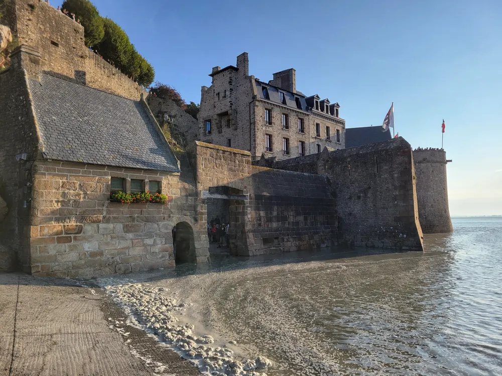
- From 12.20 m the lower gates are disrupted. The booklet's rule is that the esplanade floods from 12.80 m, and as a safety margin it also lists high tides of about 12.75 m and above as cut-off days, when the Mont is briefly an island – only a handful of days a year.
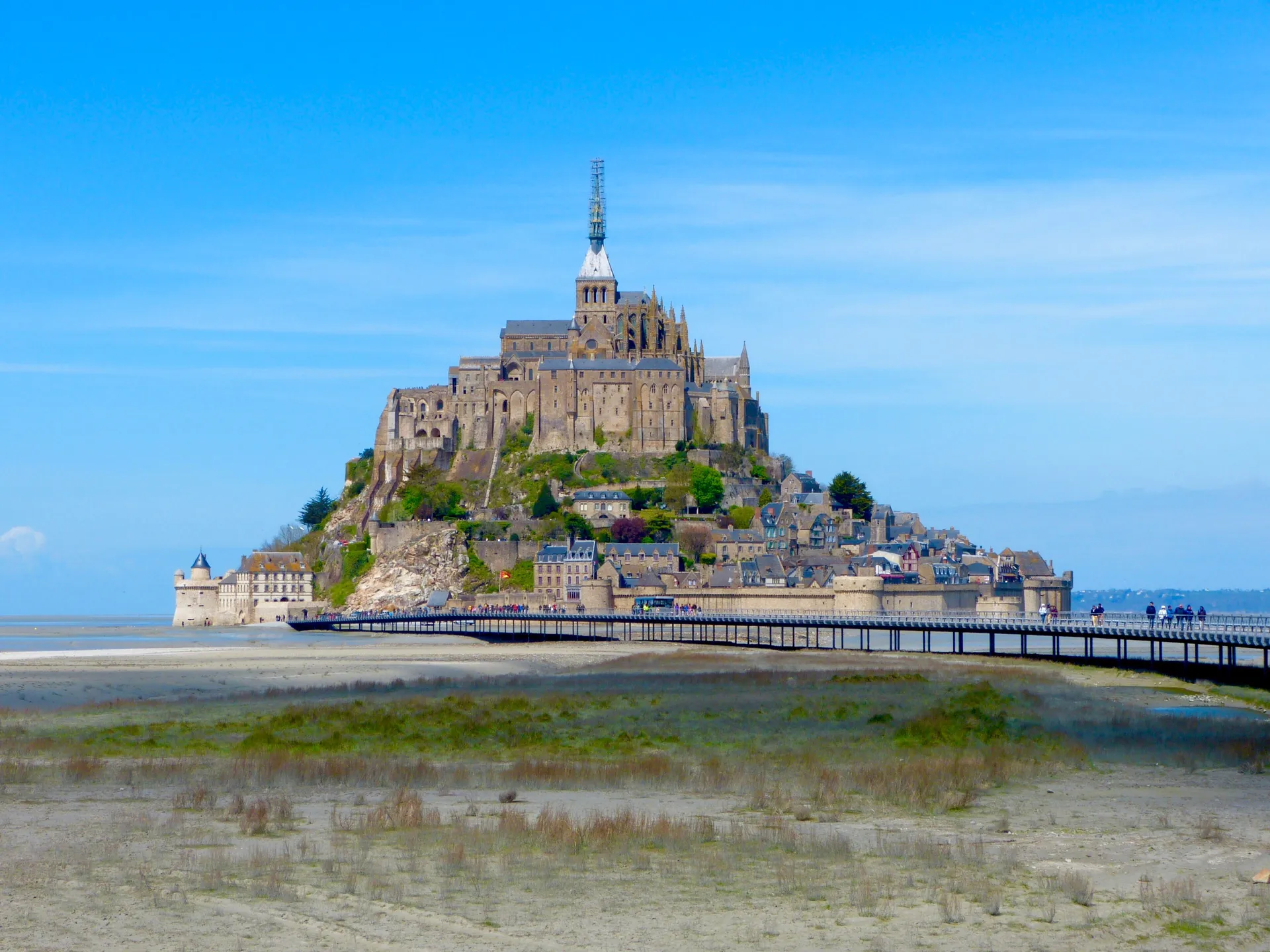
- Be on the bridge, ramparts or West Terrace 60–90 minutes before high water to watch the tide come in.
How the tides work in the bay
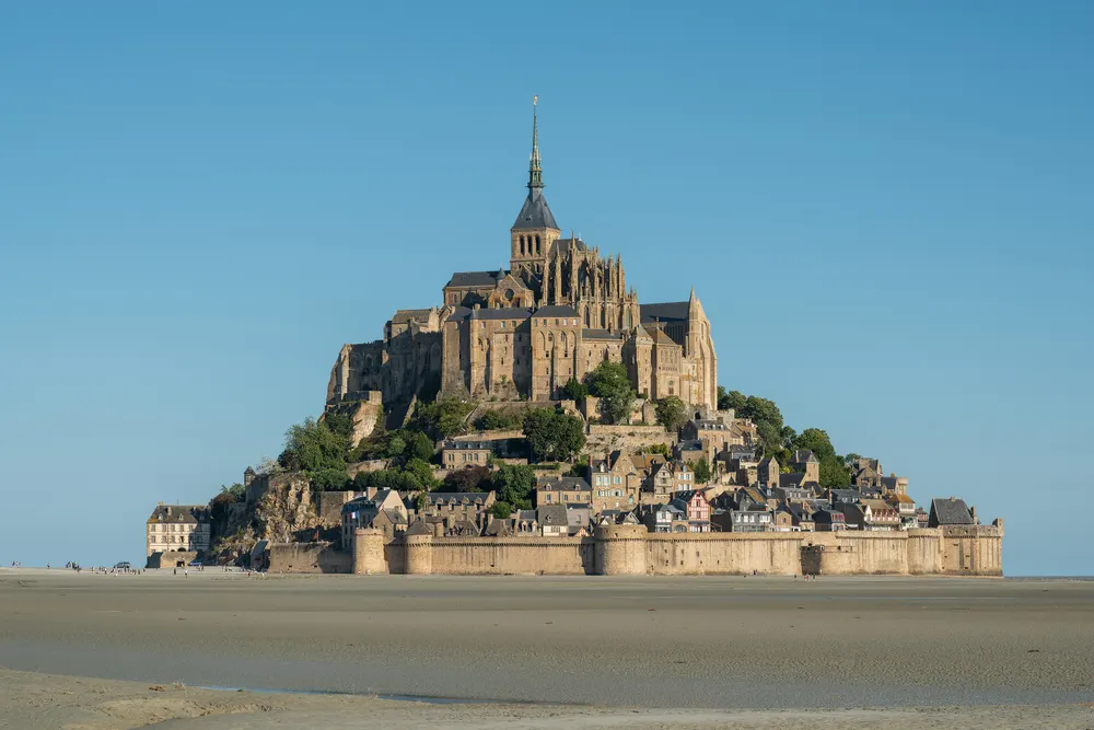
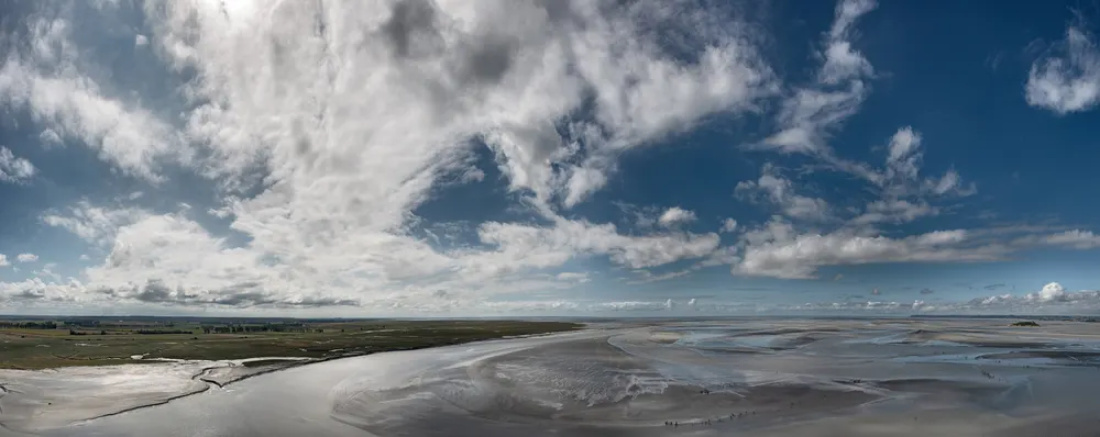
The Bay of Mont-Saint-Michel has some of the largest tides in continental Europe. On the biggest spring tides the difference between low and high water reaches roughly 13–14 metres, and at low tide it retreats so far that the rock stands in kilometres of sand, mud and channels. Twice a day the water returns across this almost flat bay, which is why it seems to arrive so suddenly.
There are two high tides and two low tides on most days, each high water about 12 hours 25 minutes after the previous one, so the times move later by roughly 50 minutes a day. The size of the tide follows the Moon: the strongest tides (spring tides, vives-eaux) come a day or two after full and new moon, and the weakest (neap tides, mortes-eaux) around the quarter moons. The very largest tides of the year cluster around the equinoxes in March and September.
Spring tides here also bring the mascaret, a small tidal bore that runs up the Couesnon and the other rivers of the bay. The official tide booklet says it is visible about 1½ to 2 hours before high water; the dam on the Couesnon, just in front of the Mont, is a good place to watch.
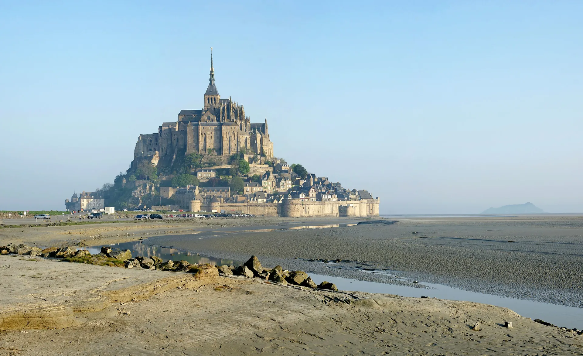
Low tide: the bay empties for kilometres around the Mont.
Tide coefficients explained
French tide tables give each high tide a coefficient between 20 and 120, defined by the French hydrographic service (SHOM) from the tide at Brest. It describes the size of the tide, not its time: the higher the number, the higher the high tide and the lower the low tide. A coefficient of 100 corresponds to an average equinoctial spring tide.
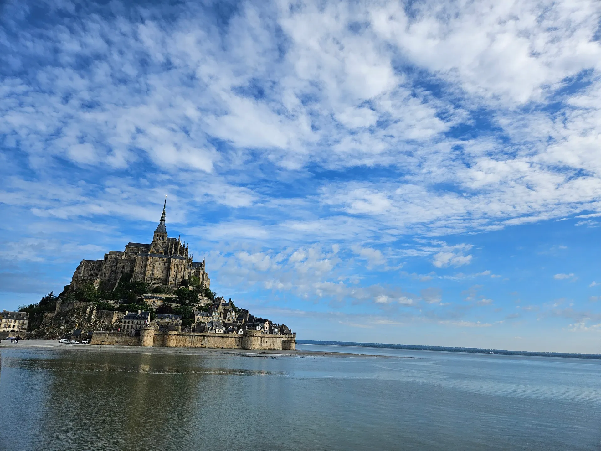
For a visitor, the coefficient answers one question: will the water reach the Mont today? On small coefficients the sea may not come near the walls at all; from roughly 90–95 upwards the bay usually fills around the rock, and above about 105 the highest tides start to affect access.
| Coefficient | What it means at the Mont |
|---|---|
| Below 70 | Neap or average tide. The sea often stays well away from the Mont; best for low-tide walks with a guide. |
| 70–90 | Moderate. Water comes into the channels and may lap the rock on the west and north sides. |
| 90–100 | Spring tide. The bay fills around the Mont – the classic "island" view at high water. |
| 100–120 | Big spring tide. Strong currents, a visible tidal bore, and on the highest days disrupted access at the gates or a flooded esplanade. |
What the water heights mean for access
The bridge and the shuttle keep running on almost every day of the year, and the Abbey keeps its normal hours. What changes on the highest tides is the last few hundred metres in front of the gates. The Établissement public du Mont-Saint-Michel (EPMSM), which manages the site, publishes these thresholds in its official tide booklet. Like our table, the booklet gives heights on the Saint-Malo scale (it notes that the actual level at the Mont is about 1 m higher):
| Predicted height (booklet scale) | What happens |
|---|---|
| Below 12.20 m | Normal access through the main gates. |
| From 12.20 m | Access through the main gates and the Fanils is disrupted; pedestrians use the path through the rocks. |
| From 12.70 m | Marine-flooding vigilance for the whole esplanade (terre-plein) in front of the gates. |
| From 12.80 m | The esplanade is inaccessible: the Mont is an island until the water drops. That is the booklet's rule; as a safety margin it also lists high tides of about 12.75 m and above as cut-off days (21 March, 14 August and 12 September 2026). Weather can shift this either way. |
| Above 13.00 m | Approximate waiting time for pedestrians: about 1 h at 13.00 m, rising to about 2 h 20 at 13.80 m (half before, half after high water). |
The best time to arrive
For the famous rising-tide view, pick a day with a coefficient of about 95 or more and be in position 60–90 minutes before high water – earlier on the biggest tides, when the water arrives fast and the best spots on the ramparts fill up. Good places to watch are the bridge (the end near the Mont), the ramparts on the west and north sides, the Abbey's West Terrace and gardens if your visit fits, and the dam on the Couesnon for the tidal bore.
High water on spring tides at the Mont tends to fall in the morning and evening rather than at midday, because of the local tidal pattern. That works in your favour: an evening spring tide at sunset with the Mont lit up is one of the great sights of France, and the day-trippers have usually gone.
On low coefficients, do the opposite: use the low tide for a guided walk on the sands and come back to the Abbey in the afternoon.
- Sat 14 NovCoefficient 58
- Low3:47 AM3.45 m
- High9:20 AM10.61 mCoefficient 58
- Low4:08 PM3.47 m
- High9:41 PM10.07 mCoefficient 54
↑ 8:12 AM↓ 5:28 PM
- Sun 15 NovCoefficient 50
- Low4:16 AM3.95 m
- High9:53 AM10.04 mCoefficient 50
- Low4:42 PM3.97 m
- High10:19 PM9.49 mCoefficient 45
↑ 8:13 AM↓ 5:26 PM
- Mon 16 NovCoefficient 41
- Low4:52 AM4.47 m
- High10:34 AM9.42 mCoefficient 41
- Low5:25 PM4.46 m
- High11:08 PM8.93 mCoefficient 37
↑ 8:15 AM↓ 5:25 PM
- Tue 17 NovCoefficient 35
- Low5:41 AM4.94 m
- High11:33 AM8.89 mCoefficient 35
- Low6:24 PM4.84 m
↑ 8:16 AM↓ 5:24 PM
- Wed 18 NovCoefficient 34
- High12:21 AM8.57 mCoefficient 34
- Low6:51 AM5.23 m
- High1:01 PM8.67 mCoefficient 34
- Low7:41 PM4.92 m
↑ 8:18 AM↓ 5:23 PM
- Thu 19 NovCoefficient 41
- High1:49 AM8.64 mCoefficient 37
- Low8:19 AM5.12 m
- High2:24 PM8.94 mCoefficient 41
- Low9:05 PM4.59 m
↑ 8:19 AM↓ 5:22 PM
- Fri 20 NovCoefficient 51
- High3:01 AM9.12 mCoefficient 46
- Low9:39 AM4.57 m
- High3:27 PM9.52 mCoefficient 51
- Low10:13 PM3.94 m
↑ 8:21 AM↓ 5:21 PM
Low tide: what you can do
At low tide the sea withdraws many kilometres and the Mont stands in a vast plain of sand, mud and channels. It is not a disappointment: it is the other half of the Mont's character, and some of the best experiences happen then.
- Walk on the sands with a certified guide. Guided walks run from the Mont and from Genêts on the Normandy shore, from a 1½–2-hour quicksand discovery walk to the Tombelaine walk (about 3 hours) and the full pilgrims' crossing (about 6 hours with breaks). Never go out alone – see bay walks.
- Walk around the foot of the rock – only with a guide, on the sand side; it shows the ramparts and La Merveille from below.
- Photograph the reflections. On a calm day the wet sand and channels mirror the Mont; low sun at dawn or dusk works best (photography).
- See the salt meadows. At low tide the sheep graze the herbus around the bay – the pré-salé lamb on local menus (food).
- Visit the Abbey and village. Low tide changes nothing inside the walls; the views of the empty bay from the West Terrace are striking.
Low water times are in the live table above. The low tide itself is not dangerous to watch from the bridge; the danger is being out on the sands when the water returns, which happens fastest on spring tides.
Safety on the sands
The bay looks like a beach at low tide, but it is not one. The incoming tide fills channels behind you before it reaches you, the sand contains patches of quicksand, and sea fog can roll in within minutes. Every year people are rescued after walking out alone.
- Never walk out into the bay without a certified guide, even a short distance from the Mont.
- Do not follow other walkers: they may be with a guide on a route planned for that day's tide.
- If you are caught by fog or rising water, call 112.
- Stay on the bridge, the dam and the marked paths at high tide.
Guided crossings and short quicksand walks run from the Mont and from Genêts on the Normandy shore – see bay walks.
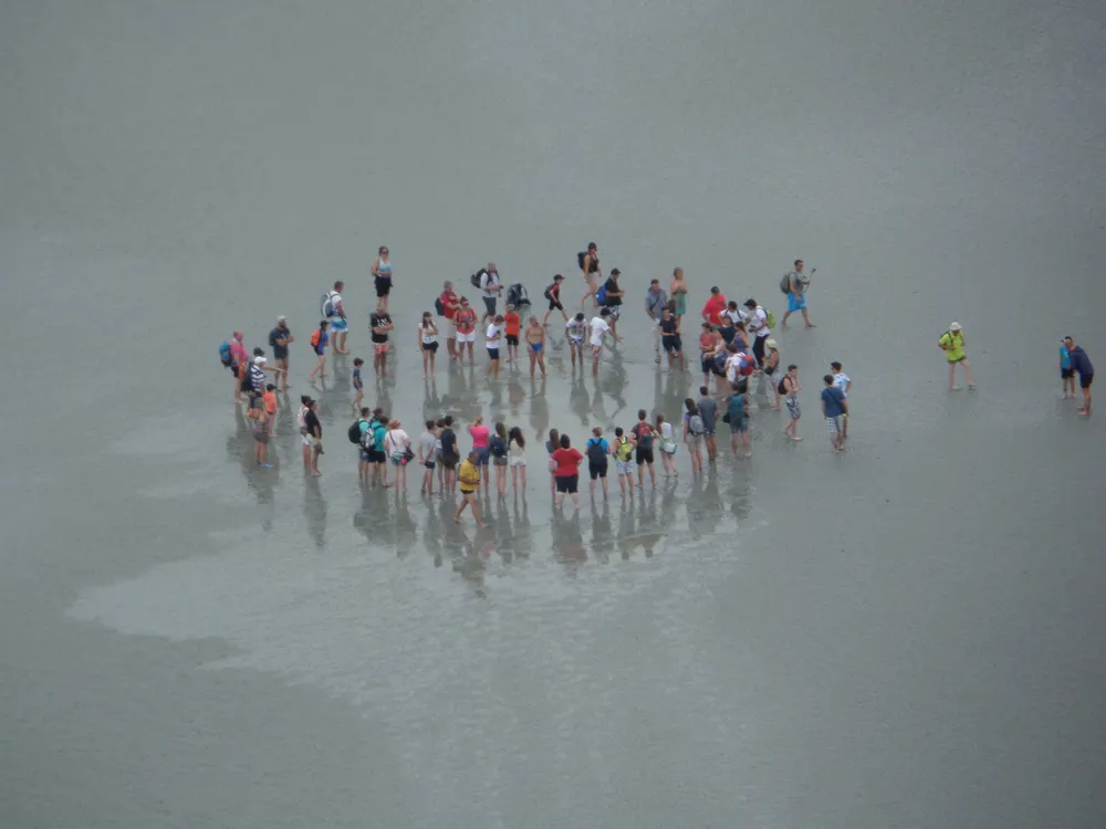
Bay walk and quicksand discovery
A guided barefoot walk on the sands of the bay with a hands-on (feet-on) quicksand experience.
Check availabilityBook via GetYourGuide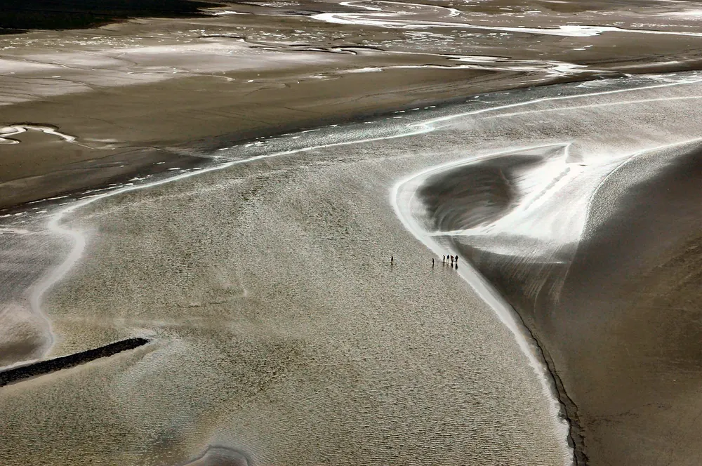
Two-hour bay walk from the Mont
A short guided walk on the sands starting at the foot of Mont-Saint-Michel, with quicksand and tide explanations.
Check availabilityBook via GetYourGuideTour listings are on GetYourGuide. Prices, times and cancellation terms are shown live on each listing and can change; MontSaintMichel.com may earn a commission at no extra cost to you.
How to read our tide table
The live table at the top of this page shows the next tides, today and the coming week, a month calendar coloured by coefficient and the upcoming days when access is disrupted. Times are Mont-Saint-Michel local time (French time, CET/CEST, adjusted for daylight saving), shown with AM/PM; heights are in metres on the Saint-Malo scale used by the official booklet, so you can compare them with the access thresholds above. Days marked as island days copy the official EPMSM booklet where it exists; other access warnings are our estimates from the predicted height.
Our tables are produced independently and checked against official predictions; they are a planning aid, not an official SHOM product. Wind and air pressure can make the real tide come earlier, later, higher or lower. Read how we produce our tide data and always follow signs and stewards on the day.
Today's tide: how to use the live card
If you have searched for "high tide at Mont-Saint-Michel today", the answer is in the card at the top of this page. It shows, in local French time:
- Next high water and low water – the time, the predicted height on the booklet scale and the coefficient.
- Today and the next seven days – both daily high tides with their coefficients, so you can see whether the tides are building towards a spring tide or falling towards a neap.
- Access warnings – further down the live block, the coming days when the path through the rocks is used or the esplanade may flood.
How to turn that into a plan: if today's coefficient is 95 or more, be on the bridge, the ramparts or the West Terrace 60–90 minutes before high water to watch the bay fill. If it is below about 70, the sea may never reach the rock – use the day for the Abbey and a guided walk on the sands instead. If the card shows an access warning, check the times, arrive well before or after the high water and follow the stewards on the day.
The times are worked out in your browser from our tide data, so refresh the page if you keep it open for a long time. Weather can make the real tide come earlier or higher than predicted, especially with a strong westerly wind.
Frequently asked questions
When is high tide at Mont-Saint-Michel today?
See the live card at the top of this page: it shows the next high and low water, the coefficient and the predicted height, in local French time.
Does Mont-Saint-Michel become an island every day?
No. The water reaches the rock on most spring tides, but the esplanade in front of the gates floods – turning the Mont into a true island – only at high water of about 12.80 m (the booklet's rule; as a safety margin it also lists high tides of about 12.75 m and above), which the official booklet expects on 0–12 days a year.
What coefficient do I need to see the water around the Mont?
Aim for 95 or more. From about 90 the bay generally fills around the rock at high water; below 70 the sea may stay far away.
Can I still visit when the tide is in?
Yes. The bridge stays open and the Abbey keeps its hours. Only on the very highest tides is the esplanade briefly flooded; then you wait about an hour on the bridge or in the village.
Are tide times the same as Saint-Malo?
Saint-Malo is the reference port for the bay. The official Mont-Saint-Michel booklet uses Saint-Malo times and heights (noting that the water at the Mont stands about 1 m higher), and so does our table, so its figures match the official access thresholds.
Is it safe to walk on the sand at low tide?
Only with a certified guide. The tide, quicksand and fog make the bay dangerous for unaccompanied walkers.
What can I do at Mont-Saint-Michel at low tide?
Join a certified guide for a walk on the sands, photograph the reflections in the wet sand, and visit the Abbey and village as normal – low tide does not affect access. Never walk out into the bay alone.
Where can I find the tide schedule for 2027?
Our live table and month calendar on this page cover 2026, 2027 and 2028. The 2027 and 2028 figures are our own predictions until the official EPMSM booklet is published; island-risk dates for 2027 are listed in high tides.
Sources and official information
Facts were checked against these official sources in November 2026. Opening hours, prices and timetables change, so confirm before you go.
MontSaintMichel.com is an independent guide, not the official site of the Abbey or of the Mont. Some links are affiliate links: tours and tickets go to GetYourGuide and hotels go to Booking.com, and we may earn a commission at no extra cost to you.